Sunday, July 31, 2022

To Leadore Day 6: Getting to Leadore

I woke with 17.6 miles to get to the road to Leadore. 

I felt so slow and tired on any uphill no matter how mild. I grinded away slowly at the hills. It was mostly trending downhill, but if the downhill was steep, I went slow so I wouldn’t fall. When it was flat or not too steeply downhill I could walk faster. 

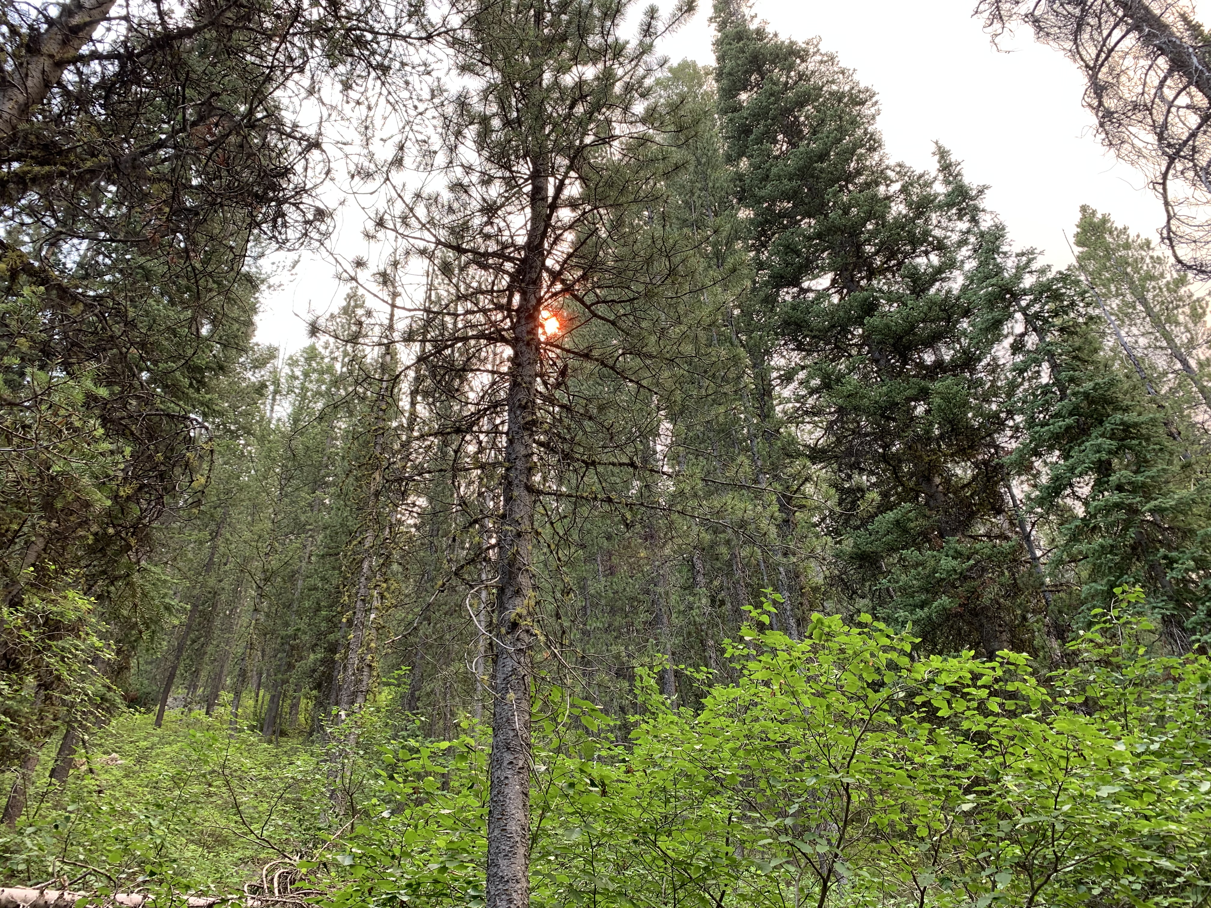
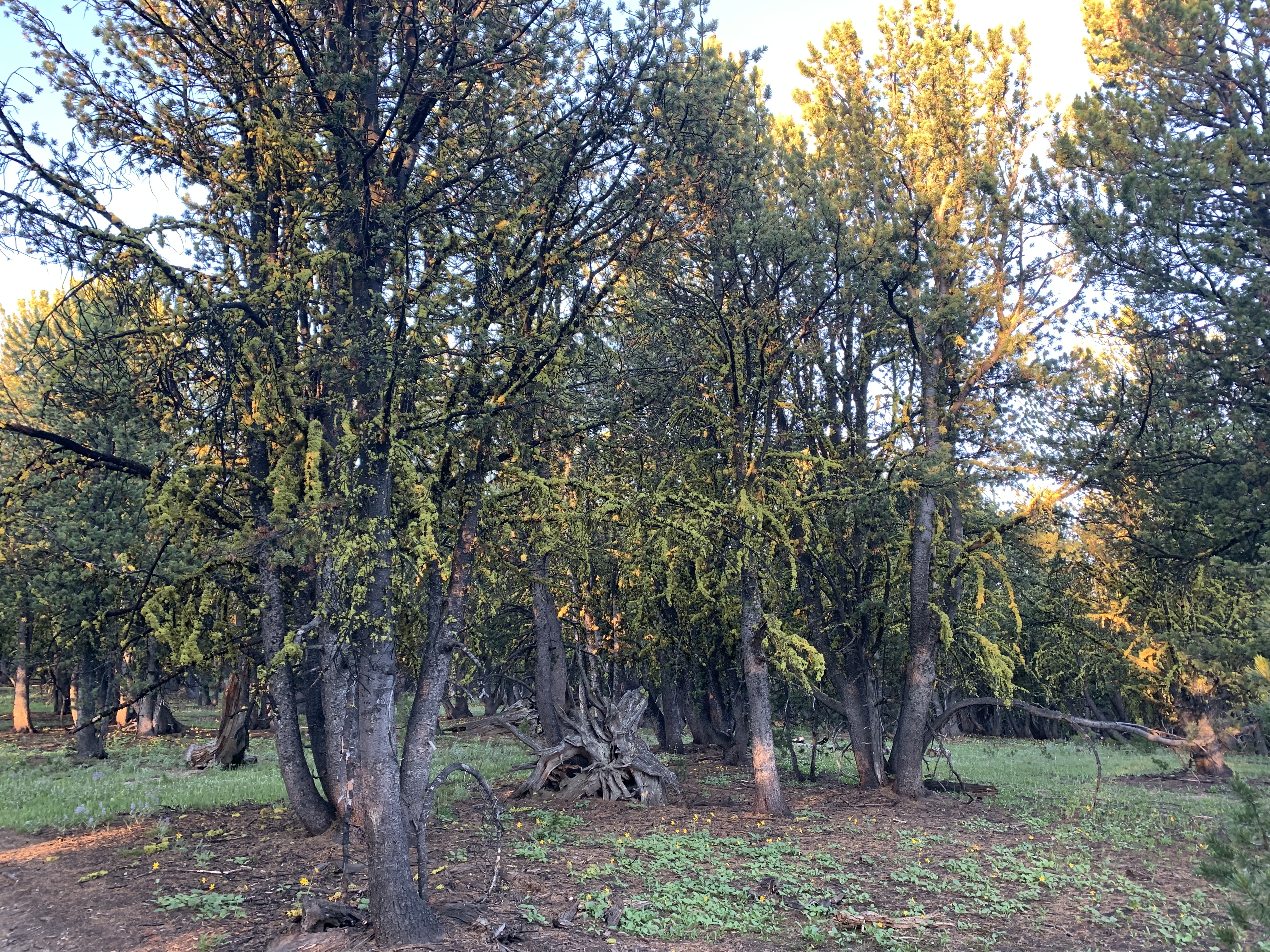
The forest was cool and shady. There were periods of grassy hills. There was a large stretch of open sage brush with cattle. 


I continued my streak of seeing not a single SOBO hiker, but I did see three NOBO hikers. 

I got water at a cistern about halfway through the day because I feared not being able to get a ride to Leadore right away. 


I met an older couple backpacking to the Sacagewhea campground. That was where I got the water after the long dry stretch. They told me the fence the trail was following was the state line and that I’d been in Idaho for the last 50 miles. 

When the road came into view I watched it for an hour and saw no traffic. There was no shade in the parking area or anywhere nearby. As I approached the parking area a truck pulled up and All-in and another hiker jumped out. They said jump in, the guy driving the truck was going back to Leadore. What a lucky break!

He dropped me off at the store where my package awaited. Wallaby, Mango and FastCash were sorting their resupply. It was nice to see them and also clear I’m a day or more behind the people I used to hike with. 

I got my box at the store, sorted my resupply and then went to the library next door where there was air conditioning. I wanted to wait a bit and then go get a burger at the restaurant across the street before the long almost mile walk to the park. 

In the restaurant I met a Canadian couple who gave me a ride to the “city park” after we ate. I felt no hunger and food didn’t taste like much. At the park were lots of hikers, some I recognized and some I didn’t. Everyone sat in the shade hiding from the blaring heat of this almost desert place. 

I took a shower and felt a lot better. I laid in the shade waiting for my charger to charge. It was nice to rest. 

I worry I cannot make it to Lima. I just have no energy. I should get stronger but I feel weaker every day. It’s 103 miles to Lima and first thing is a climb from 7700 feet to 10,000 feet. 


To Leadore Day 5: Another day that starts easy and ends in hills.

I’m starting the day at mile 694.7. I’m ending at 721.3. I hiked 26.6 miles. 

The day started downhill and flat through shaded forest. It was nice to cruise along. But any time there was a noticeable incline it felt a lot harder than it should. 

I met 5 NOBO hikers, real ones who had started in New Mexico and were not flipping around. They looked so healthy and fast. Unlike me. 

In 17.5 miles I reached the water source. It was a spring off trail. It was in some kind of little historical park or something. The water was considered to possibly be the headwaters of the Missouri River. 


Rather than walk all the way back along the dirt road back to the trail I went cross country and found the trail. The trail was now a dirt road and would remain that way for the rest of the day. I was not sure of this at first though, so I watched the app and my surroundings so that I wouldn’t miss anywhere the trail might reappear like I did the last time. I also watched the footprints in the road. If they disappeared I would know I missed a junction. But they never disappeared and once the road became a grueling uphill I knew this was the trail for the rest of the day. 

Around 6:30 I reached the junction to a spring. This was my goal for the day. Clean cold water came out of a pipe surrounded by pink monkey flowers and other colorful flowers. After I got water I looked for a campsite and found one that even had Altra shoe patterns in the dirt. 


I set up camp and ate my dinner cold since it had been so hot in the afternoon. I think I might be camped be in Idaho. I am going to Leadore Idaho tomorrow. I have 17.6 miles to go to the road to Leadore. I am running out of food. 

Saturday, July 30, 2022

To Leadore Day 4: cruiser in the morning, straight up in the afternoon

I started the day at mile 668.7 and ended at mile 694.7. 26 miles. 

I woke up really early and decided to just get up and go. I was 45 minutes earlier than usual. 

The trail started out uphill on decent switchbacks. Then it leveled off and stayed that way for a long time. I got a lot of miles in early. 

There was lots of water on the trail so I didn’t have to worry about water. I walked in forest most of the time and there were some sage brush meadows with lots of yellow flowers. There was a pond with lily pads. 


In the afternoon the trail began a climb to an overlook. At least that’s what the FarOut app called it. It was just the usual pass. I saw a pika on the way up. There wasn’t much of a view so I didn’t know why it was called an overlook. 

The trail dropped a little and then climbed up more of a mountain. It was very steep and exposed. I was afraid to look down to my right so I didn’t and I didn’t take a picture. 

Then around 5pm I reached the last water source for 19 miles. It was off trail. I filled up all my water. I still have a bit of water anxiety from two nights ago when I was not quite up the big climb and camped with just slightly less water than I needed for how thirsty I felt. So I set off for another straight up climb with ten pounds of water. 

I passed up a really nice campsite early in the climb. I should have taken it but it was too early to stop. The climb was tough and the app really should have labeled the top of this one “overlook” because there were 360 degree views. It felt a little like the Goat Rocks up there. There was a saddle and another climb. I hoped to find camping in the saddle but it was cold and windy. 


I did the second climb and it was still windy but slightly less so. Having learned from the windy night at the lake, I pitched my tarp between some small trees that I was able to tie some of the lines to. I pitched the corners all the way to the ground. I piled a lot of rocks on the stakes. I put my pack as a wind shield at one end. It held. 

Today was Sunday, July 24. I saw not a single other person today. 


Friday, July 29, 2022

To Leadore Day 3: Lots of hills and lakes

I’m starting at mile 644.5. I’m ending at mile 668.7. I hiked 24.2 miles today. 

I made it my goal to get 24 miles in. It took me 11.5 hours to do it. The hills, and there were many of them, are so steep I cannot walk very fast up or down them. 

I finished off the big climb from yesterday first off. It was much better fresh after resting and sleeping. I was a little sore and still slow but it didn’t crush my soul. 

The trail then traversed some and stayed pretty high for a while before doing the usual drop down and climb up again. The highest of the climbs brought me to 9100 feet. After that the trail was all downhill and with 3 hours to go before 7pm I made it my goal to reach the bottom at 7200 feet and 24 miles. 

There was a lot of interesting scenery that is best shown in pictures. Other than a northbound hiker who had no interest in stopping to talk, I saw no other hikers. I did see a group of girls trail running with their coach. He gave me some fruit gummies. 


I camped in a little nook by a noisy creek. It was a warm night and the thick forest and solitude reminded me of Oregon and Washington. 


Thursday, July 28, 2022

To Leadore Day 2: the big hill

I’m starting the day at mile 622.6. Ending at 644.5. 22 miles. 

Everyone started at the same time as me which was around 6:30am. 

It did not take long for me to not see anyone else all day. First I missed a junction and went at least a mile round trip the wrong way. Then the hills became very steep and my pace slowed way down. First there was a drop down to 5700 feet. It was very warm down there. Then the big climb to 9100 feet began in earnest. There was a loss of altitude to cross a stream early on. 


I labored slowly for the afternoon then chose to get water for camping at about 5:30 and be on the lookout for some flat spots mentioned in the comments. I did not find them so I found my own small flat spot. At 6pm my tarp was set up and my dinner was cooking. 


Twenty-two miles isn’t bad. There are a couple more miles to a sort of top. I’ll do them tomorrow. After that the day should be milder hiking, kind of level for a while then some ups and downs taking me to 9100 feet. 

I’m grateful to have my big tarp. As long as there’s a flat spot big enough for me, the rest of the area covered by my tarp can be rocky, have bushes or logs and it doesn’t matter. I’m also grateful the high winds never came. 

Wednesday, July 27, 2022

To Leadore Day 1: Nero to a tent site.

I hiked 5.7 miles to a tent site. It was dirt road all the way. My pack was heavy. There was a nice spring to get water before the tent site and there wasn’t a chance for water again for 5 miles. 

I got a late start leaving town. There was a lot of dithering about the fire ahead and the bad wind coming tomorrow and whether or not we should proceed. It was really hot in Darby and that made the idea of hiking unappealing. In the end I decided I would just go. I saw a few had also decided the same. Lotus was going to skip this section but as I was leaving she was running to the grocery store to buy her resupply. 

It took me three hitches to get back to the trail. The first one left me at Connor. The guy was goofy and told me lies. Said he was a firefighter but he had no muscle and his skin looked like he never went outside.

The second was a more normal guy. He left me in front of a campground. 

As I stood in the blazing sun trying to get a ride I watched a couple in their motor home struggle with mechanical problems. They backed it down the hill and then somehow stopped it partially in the roadway. Cars would veer around it. I felt a little nervous being right there. The man finally got out to push it out of traffic then tried to start it but it would not start. 

The sun was hot and I did not feel well. I walked into the forest service campground and found a bathroom. I felt a little better after. I should have written down the name of the campground because it was a nice one. 

Back on the road I soon got a ride from a really cool guy who was going mushroom hunting and was going to the same parking area where the trail is. He was really nice and finally someone not on drugs or political or weird. 

I ended my day in the tent site with Lotus and two guys. My stomach was not right so I just had a little snack and some emergence-C which was unfortunate because now my food wouldn’t be any lighter tomorrow. 


Tuesday, July 26, 2022

Made it to Leadore, Idaho

It took me 6 hiking days, the first day only 5 miles, to get to Bannock Pass at mile 738.9. Bannock Pass was the access point for Leadore. If I can, I’ll try to do individual days’ posts with pictures but I may not be able to.

This last section was very hard. I felt weaker and weaker every day. I rest stepped up every hill. They don’t ever feel easier, only harder. I may have been suffering a lack of electrolytes. I don’t really have hiker hunger. It’s hard to sleep some nights because my legs and feet hurt and won’t relax  

I fear the next section which starts in barren sage scrub with no shade and takes you to 10,000 feet in 10 miles. Will I make it?

The trouble with the trail towns and places I’ve stayed is a lack of WIFi. I either have none at all or it is weak or insecure and so it makes it hard to upload pictures or video. I don’t expect things to improve. 

Here are a few pictures. 


Thursday, July 21, 2022

To Darby Day 5: Hospital

With only 2 miles left to the highway I tripped fell and cut my forehead. 

I landed on my forehead. Nothing broke my fall. It bled profusely and I put a bandaid on it and kept going. 

I got a ride from highway 43 to highway 93 from the guy who camped near me. He said he enjoyed my mandolin playing last night. 

I got a second hitch from a sort of scary guy all the way to Darby. He turned out to be very kind. He had actually passed by and turned around to offer the ride. He thought I needed help. It was 31 miles to Darby and he wouldn’t accept any gas money. 

I went to the grocery store after having breakfast to get something for my wound. It began bleeding again so I decided I should go to the health clinic instead. But the clinic was closed. So I hitchhiked to the hospital in Hamilton. I got a ride by a nice middle class couple. 


They glued my forehead back together after properly washing it clean. Then I hitchhiked back to Darby and stayed at the RV park. Darby was a nice town to stay at. I only stayed one night but I lingered and did not head back to the trail until the afternoon. 

To Darby Day 4: Transition zone

I’m starting at mile 590. Ending at mile 614. 24 miles. There are 2 miles left to the highway to Darby. 

The day’s hikes had the feeling of a transition zone. Like how the PCT will have dull stretches in between the more interesting higher places. There wasn’t much to say about it. There were a few spots with nice views but most of it was dry and boring and in various states of regrowth after fires. At least the weather was mild and the grade gentle. I made good time. I saw nobody else for the entire day. 


There was a 17 mile water carry. I took about 4 liters from the last reliable source to last the rest of the way to Chief Joseph Pass. I made some pudding to eat later, which I did at 2:30 while sitting in the shade cooling my feet. 

I had cell service and called Tony. 

I pretty much just put my head down and put in miles until about 6:30 when I stopped at a tent site listed in the app 2.2 miles from the Chief Joseph Pass exit. There was a truck and small RV nearby. I hoped someone would come out and offer me a cold drink but they didn’t. 


To Darby Day 3: Howling wind, crashing trees and forest fires

I’m starting the day at mile 565 and ending it at 590. A grueling 25 mile day. 

I was still exhausted from all the climbing yesterday. There were two more up and down passes to do. I fell in the creek between them and lost the drinking cap to my water bottle. 

Then the hills were less intense but I entered a very long burn zone with many blowdowns. The wind howled and I listened to trees fall. There was a forest fire burning in front of me. I wondered if it was on the trail. A few hours later I could see another forest fire burning on the other side of me. It was like being in hell. 


There was a long water carry through miles of burned forest and blowdowns  because comments in the app said they couldn’t find a spring. A helpful northbound section hiker told everyone how to find it. When I got there the men from last night and the Canadians were there. The Canadian man gave me a liter of water. 

The trail climbed through more burned forest with more blowdowns. As I labored the Canadian woman’s pack appeared on the trail. I assumed she was pooping but I looked up and saw her hiking without it. The trail finally leveled off in unburned forest and the Canadian man appeared without his pack headed back down to retrieve hers. Everyone today had come up to me from behind and essentially blasted me out of their way, including the men and the Canadians. At times I wanted to cry at how rudely I would be forced to jump out of the way. But nobody carried my pack. I was doing all the same miles on my own at my own pace. 

As I crested the summit into reasonably healthy forest it appeared I might make it to the next water source without dry camping. 

I plodded along, passing some nice dry campsites battling in my head which mattered more: to not exhaust myself with too many miles and get adequate rest or to camp among other people? Suddenly the creek appeared and there were no campsites nearby so I grabbed some water and went searching for a place to camp. Soon I was at Surprise lake and there were the German Belgians in their tent. 

I tried to set up my tarp but it was just too windy. I packed up and went further. There were the men from yesterday. It seemed a little calmer on their side of the lake. I found a spot somewhat far from them and managed to set up my tarp partially tied to trees which seemed more secure. The cold wind was still blowing. It didn’t look promising but my tarp held while I made and ate my dinner and wrote in my journal. 

It was such a long and brutal day. This is the Cruelty Delivery Trail. But on the bright side I carried my own weight and did as many miles as anyone else and I even managed to set up a tarp shelter in wind and it did not fall down. 


To Darby Day 2: Lakes and passes

I tried to get an early start. I got up with the first bird I heard. It was still dark enough it was hard to see. I made hot oatmeal and cold coffee mixed up in a breakfast essentials drink. It was too much. I had a hard time hiking at first. 

This mountain lake actually had a dam on it. I walked over the dam to resume the trail. I had about 3 and a half miles to get back on the official CDT, the “red line” for the color of the trail on the FarOut app. 

The trail climbed humanely to Storm Lake Pass. Then it traversed over to a cool alpine area called Goat Flat. That’s where I rejoined the CDT. 


The trail then entered a really beautiful forest of larches. 


All day I climbed passes and then descended into valleys and climbed more passes. I think there were at least four or five. Many of them were very steep. The second to last, the one that went by Warren Lake, was the steepest of all. The downhill on the other side was just as steep. When it was done I had nothing left but I still had 3 and a half more miles. 

The last miles were slow. I felt like every rock and root conspired against me. My goal was Rainbow Lake and when the lake came into view I cried. 

I took a little refreshing skinny dip in the lake. I did not swim, just sat on a submerged rock and washed my skin. I hoped it would help me sleep better. 


I ate mashed potatoes with real butter and real cheese and tuna in sunflower oil for dinner sitting around a campfire ring with no fire with three guys who I had seen a number of times throughout the day. They told me they saw Mowgli when they arrived at the lake and that I arrived not very long after. I would have thought Mowgli would have gotten much further faster than that. 

For as hard as this day felt and for as much as I struggled and rest stepped maybe I’m not in as bad shape as I think.

I pitched my tarp only feet from the lake. That’s not very leave no trace. People in Montana kinda do whatever but the nature doesn’t seem destroyed here at all. Maybe the short summers contain the damage. 

To Darby Day 1: Lakes

I only hiked 8.3 miles today. But I hitchhiked 11 or 12 so whatever. 

I was reluctant to return to the trail. Relaxing in the air conditioning was appealing. But I left at 12:30 and hitched to the end of the pavement. My feet couldn’t do any more pavement. 


The dirt road was lined with very large mushrooms. It was hot and sunny. The dirt road became a trail to Twin lakes and it, too, was hot and sunny. My pack felt heavy with 5 days of food. There were lots of day hikers it was Saturday and the trail is not difficult or far from Anaconda. 

Eventually the forest became thick. The trees were much larger and healthier. The forest duff underfoot was soft and springy. There were side creeks and moss on the ground. 

The trail became more narrow after the two lakes. It climbed steeple first to a boulder field and a meadow and then almost straight up to Twin Lakes Pass. On the other side of the pass thunder started brewing and I hurried to Storm Lake to try and find a campsite. It started to rain. 


Mowgli appeared as I reached the lake. There were car campers at the lake and he was disappointed. I didn’t care and started looking for a good site. I found a nice one just as it stopped raining. I could hear car engines idling, kids playing and dogs barking but I didn’t care. It’s a nice lake and I’m only 3.6 miles away from the red line and I feel I can relax here, sort of continue my Nero day. 


Sunday, July 17, 2022

Update from Anaconda

 I’m leaving Anaconda today. I stayed at the Pintler Portal Hostel and was able to make a video. 


To Anaconda. Day 4 in this section: McDonald’s

I woke up early. After yesterday’s heat I wanted to maximize the coolness of the morning. I was 10 miles from McDonald’s in Anaconda. 


I slipped a note under Wallaby’s tent and headed out behind the Belgium folks who are unfriendly and insular. They soon faded into the distance. Everyone walks faster than me. 

I walked along a winding river. The mosquitoes were fierce. The morning was colder than expected. The road turned to pavement and I tried to walk in the dirt on the side. The speed limit was 70. People in cars were polite, slowing or pulling over or both. 


I walked by a correctional facility and could see men exercising in a cage. This contrasted with me exercising the kind of freedom of movement most people don’t even attempt, and I was doing it for self-actualization reasons. 

Eventually I turned on the last highway that would bring me to town. Town wasn’t where I thought it would be. I’m still not used to reading the app/map in a SOBO direction. 


My first goal was McDonald’s. They have clean bathrooms, delicious breakfast sandwiches and a place to sit. Soon lightning appeared on the horizon and rain began to fall. McDonald’s would also be dry and warm. 

I made it in time for breakfast. I turned down two offers of rides to town. Road walking this 10 miles felt like a big accomplishment. 


Mowgli had been here already for a night. Wallaby had camped with me at the trail angel. Lotus, FastCash and Mango were behind. I began wondering if I should separate from them. I cannot hike as fast but I can get up earlier and hike longer hours more steadily than them. I like their company at night but I end up alone almost all day anyway. Enduring the rain and mosquitoes seems easier knowing I’m not alone. I need to decide what to do.